
Trace a Waukee Street Address
An exact house number is the best starting point. Waukee publishes an Address Table that breaks an address into number, direction, street name, street type, and unit. Its PIN, or parcel identification number, carries the search into the parcel layer. That link is much sounder than assuming a mailing name is a resident. Use the chain below for a street directory search, and record the date of each result because maps, boundaries, and names change.
- Find the address in the Waukee Address Table. Copy the displayed address and PIN.
- Open the matching parcel and compare its property address, mailing fields, legal description, subdivision, and tax district.
- Check the Dallas County assessment or tax search. Treat owner and mailing fields as ownership clues, not a list of occupants.
- Use the current grantee or legal description in the Dallas County Recorder index, then work back through each seller and earlier deed.
- For a lawful registration check, the Iowa voter lookup needs a person's first name, last name, and ZIP. It cannot browse a whole Waukee street.
Older household research belongs in a dated directory, phone book, census, or newspaper. The modern street chain stays focused on parcels and recorded events. When a current parcel opens a past-household question, the Waukee city directory collections provide the historical shelf without turning an old entry into a claim about present residence.
Search Waukee Streets by Field
The county property-tax search offers familiar form controls, while Waukee's public GIS exposes far more field detail. A short street name can return several suffixes, so include the house number, direction, suffix, and unit when known. The street directory becomes more reliable when the same address is found in both sources.
| Search field | Control | How it narrows Waukee records |
|---|---|---|
| Owner | Text | County tax search; matching rules are not published. |
| Parcel number | Text | Direct PIN route; format and wildcard rules are not published. |
| House number | Number/text | Pairs with street and unit to isolate an address. |
| Prefix direction | Select | N, S, E, W, NE, NW, SE, or SW. |
| Street and suffix | Text/select | Supports street types such as AVE, BLVD, CT, DR, LN, PKWY, RD, ST, TRL, and WAY. |
| City and unit | Text/select | Separates similar roads and multi-unit sites. |
The Dallas County property-tax search is a useful second view when Beacon does not load. Search and Clear controls are public, but the county does not publish its exact matching logic or export limits. A blank hit calls for a spelling change, parcel search, or help from the Assessor, not a claim that the address has no record.
The Dallas County Assessor page is shown in the captured view below. It provides the county's official route into assessment work, while the page after the image explains why the city GIS is still needed for address-level detail.
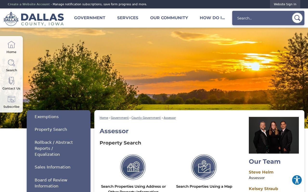
Use that office route to confirm assessment terms and field meanings. The county says assessments take effect January 1, with reassessment normally occurring in odd-numbered years.
The separate Dallas County tax form shows the address controls a visitor can use when the map route is not enough.
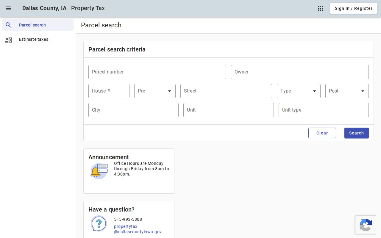
Its parcel, owner, house, street, direction, city, and unit controls make it a useful cross-check, though its coverage dates and export rules were not published.
Waukee Records Indexed by Address
No single Waukee street directory contains every person or event at a site. Each custodian records a different fact. The City of Waukee maps an address and parcel; Dallas County assesses and taxes property; the Recorder files deeds and plats; Community Development publishes permit reports; election officials govern voter access. Compare sources only where their dates and meanings overlap.
| Address record | Official keeper | Evidence available | Access route |
|---|---|---|---|
| Address Table | City of Waukee GIS | Address parts, PIN, subdivision, built and utility attributes | ArcGIS REST query |
| Parcel and assessment | Waukee GIS and Dallas County Assessor | Property, mailing and primary fields, values, tax district, legal description | GIS, Assessor, Beacon, or tax portal |
| Recorded deed or plat | Dallas County Recorder | Grantor, grantee, instrument, date, book/page, and title trail | AVA index or Recorder counter |
| Permit report | Waukee Community Development | Address, work type, date, value, applicant and owner fields | Monthly archive or records request |
| Voter information | Iowa SOS and Dallas County Auditor | Personal registration lookup or regulated list fields | Name-and-ZIP lookup or lawful list request |
A parcel number links the map to the tax roll, while a legal description links land to a recorded deed. Street spelling connects permit reports and plans. Voter information is a separate system with statutory limits, not an open map layer. This distinction keeps a Waukee by-address search from blending several unrelated names into one household.
Waukee GIS Splits the Street
The Waukee OpenGov service divides its data into Address Table points and Parcel polygons. An address point marks a location. A parcel polygon draws the land boundary and holds legal, value, and tax fields. The service also lists PD-1, Zoning, Corporate Boundary, Subdivisions, and Flood Zone layers. Query and query-by-distance are supported, with JSON, GeoJSON, and PBF output and a 2,000-record maximum.
The Waukee Address Table view exposes the point-layer fields that begin the PIN workflow.
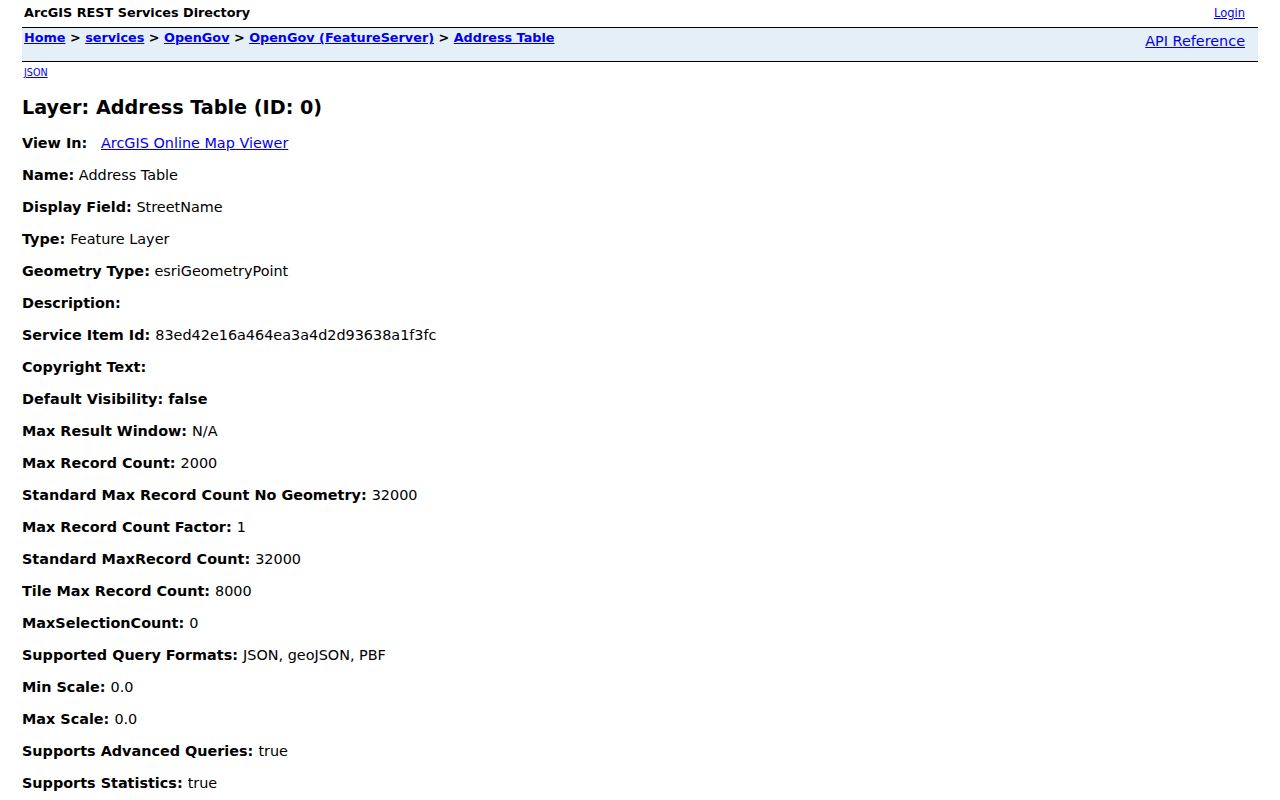
The field list makes the split between a mapped address point and the richer parcel polygon clear.
- Parcel
- A mapped piece of land identified by a PIN; it may contain one or more address points.
- Situs address
- The physical property address, distinct from the address used for tax mail.
- Plat
- A recorded map that establishes lots, blocks, roads, and subdivision boundaries.
- Criss-cross directory
- A historical directory arranged by street and house number instead of only by surname.
The public parcel layer appears in the image below. Its field inventory includes PIN, CountyID, property address, mailing and primary names, legal-description fields, section, township, range, acreage, exemptions, assessed value, TIF, and tax district.
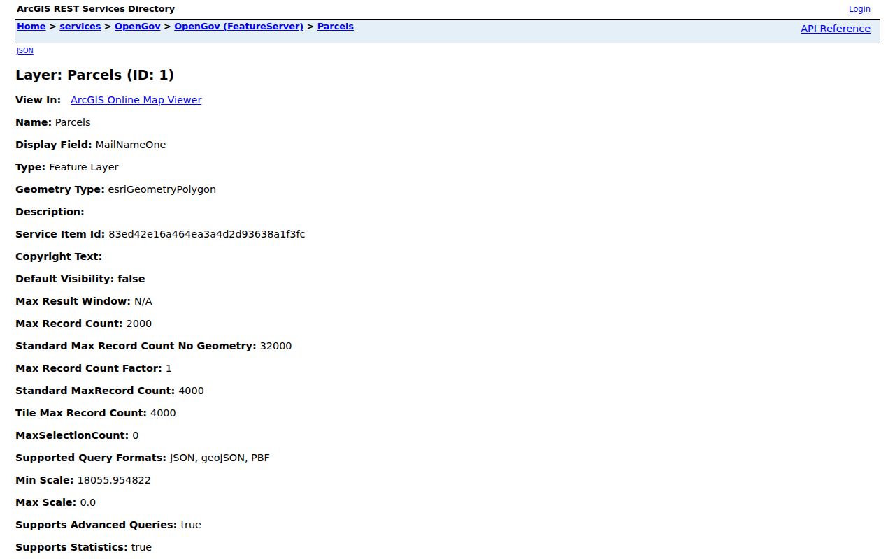
The metadata supports a repeatable PIN-based search. It does not document a simple human-interface button that browses a whole street, so avoid promising controls the service does not name.
Note: Dallas County warns that GIS maps are compiled aids, not surveys; use recorded plats and deeds for legal boundaries.
Three Waukee Address Meanings
A Waukee street search may show a property address, mailing address, and legal description. They answer different questions. The property address marks the mapped site. The mailing address tells where tax correspondence goes, which can be outside Waukee or directed to a trust, firm, or representative. The legal description ties the land to a lot, block, subdivision, or section-township-range description.
PrimaryNameOne and MailNameOne are field labels in the Waukee parcel data. Keep those labels when reporting a result. Neither label proves current occupancy. Even an owner name may identify a person who does not live at the property. Confirm title through the Assessor or Recorder, and use personal registration tools only for their stated purpose.
Follow Waukee Streets Into Deeds
Begin a deed chain with today's PIN and legal description. Search the Dallas County Recorder route and its Fidlar AVA index for the current grantee, meaning the buyer who received the property. Retrieve that deed and note the grantor, the seller. Search the seller as an earlier grantee, then repeat. A street name can change, but the lot and legal description often preserve continuity.
The current AVA fields and online coverage dates were not visible during research. When the index stalls, visit or contact the Recorder at 800 Court Street, Suite 130, Adel, call 515-993-5804, or use its contact form. The office is open Monday through Friday, 8:00 a.m. to 4:00 p.m. Historic SHSI Dallas County land records extend back to the nineteenth century, including land records from 1849 and indexes from 1857.
Read Waukee Permits by Street
The Waukee monthly permit archive was visible from May 2023 through July 2026 when inspected. A sample report lists record number, address, record and property type, issue date, valuation, square footage, applicant, owner, and owner mailing fields. It can date a build or alteration and connect a named applicant to that specific filing.
A permit is not a deed and does not prove occupancy. If a month or detail is missing, send a bounded request to the City Clerk under Iowa Chapter 22. Waukee accepts public-record requests in person, in writing, by phone, or electronically. Ask for one address and a clear date range. Code cases and utility hookups have no single public street index, so the custodian route matters.
Note: Save the permit report date and record number because the archive is updated as new monthly reports are added.
Waukee's Triangle Breaks the Grid
Waukee's oldest street pattern is not a plain rectangle. The city was laid out beside the railroad in 1869, and the Downtown Master Plan describes the diagonal rail crossing as the Triangle. An old deed, newspaper item, or directory guide may describe frontage in a way that looks odd on a modern subdivision map. Plot the rail line first, then compare the dated street and parcel sources.
No official Waukee renaming or renumbering chronology was found. Use the current Address Table, recorded plats, deeds, city plans, and City Clerk ordinances to bridge an older name. The Corporate Boundary layer also matters: a Waukee mailing city or the verified 50263 ZIP does not prove that the parcel lies within the present city limit. Current annexation and development work makes the date of the map part of the evidence.
Newer Waukee plans add another time issue. Current development documents name roads and plats before every layer may reflect the same stage of work. A planned road is not yet a settled postal address. Save the plan title and adoption date, then compare it with the live Address Table and the recorded subdivision plat. This extra check is useful near growth areas where a parcel, street, and city line may change on different schedules.
Waukee Voter Data Is Limited
The public Iowa voter lookup asks for first name, last name, and ZIP. It checks a person and polling information; it does not return everyone on a street. A full voter-list request is a different process under Iowa Code sections 48A.38 and 48A.39, with selected jurisdiction, status, format, price, timing, and purpose controls.
Do not treat nonappearance as proof that no one lives at an address. A person may not be registered, may have moved, may use protected information, or may not match the exact search. Safe at Home offers eligible survivors a substitute address and confidential election options. Public research should never be used to work around those protections.
Limits of a Waukee Street Directory
Official address records describe parcels, owners, applicants, documents, and regulated registration facts. They do not publish a complete list of renters, family members, guests, utility customers, or everyone who receives mail. Driver and vehicle address data follows separate privacy rules. A commercial neighbor tool may also merge stale web data with public records, so it cannot replace a dated custodian source.
Use the Waukee street directory method for family history, deed research, estate questions, a seller check, civic review, or neighborhood and property curiosity. State exactly what a record says and when it said it. If a mailing name and deed disagree, ask the Assessor or Recorder rather than guessing which person occupies the site.
A careful result may be modest: the parcel layer showed one mailing field on a stated date, the deed index showed a named grantee on another, and a permit report named an applicant for specific work. Keeping those facts separate is more accurate than calling all three people residents. It also makes later review possible when Waukee or Dallas County updates a portal.
Lawful use. Waukee address records may be consulted for lawful personal research. Never use them to stalk, harass, intimidate, or evade a protected address.